Historian John Gurda walks through the history and landmarks along Milwaukee's North Avenue, from east to west, to help us understand how it became what it is today.
“It's an interesting way to look at a city, kind of a transect through space and time,” he says Gurda. "... [It’s been an arterial street] from the 1840s up to modern terms."
Starting at Lake Michigan (now Milwaukee's east side)
North Avenue was officially named in 1856, but stretched only as far as the city limits. Beyond that was farmland.

The North Point Water Tower was built in 1871. "The water pumps were down there at the foot of the bluff, and they were pumping water to a reservoir in what's now Kilbourn Park on North Avenue, just on the west side of the Milwaukee River. And they put a standpipe in there, four feet in diameter, to relieve pressure on the main pipes. And Milwaukee surrounded it with a sort of fairy tale castle, and that remains, certainly, the North Avenue icon on the lake, and remains just a very, very powerful statement of civic pride and possibility."
In 1858, the hospital, now Columbia St Mary's, was moved from downtown Milwaukee out to North Avenue. “There was already at that site there ... a poor house and there was a pest house, which was a very kind of a Dickensian — like a hellhole for people who were indigent and sick. ... So that's why you have all those social service institutions and schools right there in that section of the east side," Gurda explains.
Five points on Farwell Avenue and North Avenue has always been kind of entertainment and gathering. The Oriental Theater was built in 1927 during “kind of the golden era of the movies."
Harambee neighborhood (Bronzeville throughout history)
The big corner that is now Martin Luther King Drive and North Avenue goes back to the 1870s and was the downtown of Milwaukee's German population.
The big landmark was Schuster's Department Store on Garfield, a block south, which opened in 1884.

Those neighborhood shopping strips then became the 21st century Bronzeville as African Americans became the dominant group.
"It suffered through the Riot of 1967 and the epicenter of that violence was the corner of ... King Drive and North Avenue, and pretty much became a commercial ghost town," Gurda says.
In more recent years, it has been revitalized with the Black Holocaust Museum, Bronzeville Arts Collective and the redevelopment of the old Schuster's. "This building that it stood vacant, you know, for decades, and now it's again, brimming with new life. So there's a whole lot going on there. It's fun to see," he shares.

Moving west to Lindsay Heights and Amani neighborhoods
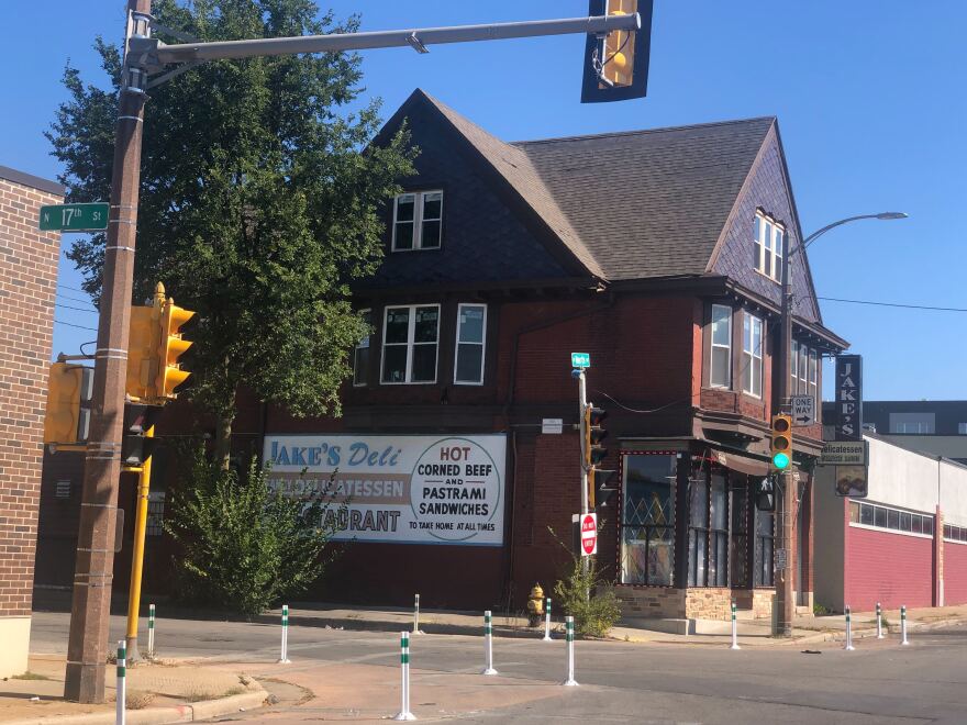
Jake's Deli has been there for a very long time — that's kind of a landmark of the Jewish settlement in that area. There's also what's now greater Galilee Baptist Church, which began as Beth Israel, on Teutonia.

One of the big things happening there now is Walnut Way — wellness, urban gardening, housing reclamation.
As go farther west, and you've got the old Sears store on Fond du Lac and North.
"Thousands of people were displaced [in the 1950s and '60s] for the Park West freeway corridor, for this freeway that was never built, and there's still open land there. So that was a real body blow to that entire neighborhood," Gurda says.
"Housing and businesses that were just erased … loss of tax base, loss of population and loss of a sense of place in that neighborhood as well. And I think that slowly is being recovered. A lot of community groups, a lot of community efforts there to kind of rebuild a sense of place, a sense of belonging."
Into Sherman Park and Washington Park
Washington Park is to the south and Sherman Park is to the north.

"Now you are getting to housing that was developed in the 1920s when you had zoning, when you had building code setbacks and when you had cars," Gurda explains.
"And the line there is the 30th Street Industrial Corridor that was second only to the Menomomee Valley in terms of industrial jobs, and that has been pretty much hammered economically, and is now slowly but steadily coming back."
This area was the border between the more 19th century city and the more modern 20th century and later city.
Washington Heights out to Hwy 100

Mayfair Mall opened in 1958 and that became a center of commerce. "And in some ways echoes the center of commerce at King and North ... so you have the continuity across generations and how we do things differently. You know, the automobile entered oriented shopping center with an ocean of parking compared to the streetcar, the commercial strips of King Drive and North. Certainly see an interesting contrast."
North Avenue into Waukesha County
As you head further down North Avenue into Waukesha County, it becomes "more a part of the generic development, post-war Milwaukee area when you have this corridor of wealth."
"After World War II, people didn't care about old buildings. People didn't care about old neighborhoods. They were happy to kind of move out to the great beyond the suburbs and have their half acre lot," Gurda shares.


